Zugspitze railway bored four kilometres through limestone in 1930
A rack railway carriage climbing a snow slope with a summit station abovePhoto: 2019-08-01 Zugspitze 8 · Wikimedia Commons
The Zugspitze stands at 2,962 metres, and the international border runs across its summit plateau. The Bayerische Zugspitzbahn has been threading a route up through the mountain's interior since 1930.
What you are standing on
The Zugspitze is limestone, part of the Wetterstein range, and it carries the highest point in Germany on a summit that it shares with Austria. The border between Bavaria and Tyrol does not stop at the foot of the mountain and resume on the other side — it climbs with you, traces across the plateau, and divides the installations at the top. Austrian cable cars arrive on the Tyrolean side; the German rack railway and the Zugspitzseilbahn cable car from the Eibsee arrive on the Bavarian side. Two countries, one summit, and a cadastral line that the summit cross straddles.
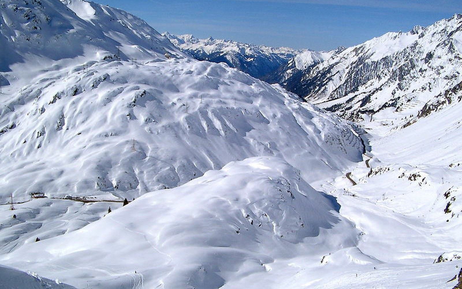
The rock underfoot is Wetterstein limestone, laid down as a reef in a shallow tropical sea during the Triassic period, roughly 230 million years ago. Compression and uplift did the rest. The same formation runs through the Zugspitzmassif into the Mieminger Kette across the Austrian border, and the Zugspitzplatt — the high plateau below the summit — is a karstic surface: pitted, channelled and largely snowbound for most of the year. What glacier ice remains on the Zugspitzplatt, the Zugspitzgletscher and the Schneeferner, has retreated sharply over recent decades, and the rock beneath is increasingly exposed.
The summit sits at the junction of Bavaria and the Austrian state of Tyrol, and the border stone marking the crossing is a documented geodetic point. Bavarian survey records have fixed the peak's height at 2,962.06 metres, making it the fifty-eighth highest in the Alps overall — a mid-ranked summit by Alpine standards, but the highest within Germany's boundaries, which is what gives it its particular gravity.
The railway and how it gets there
The Bayerische Zugspitzbahn leaves from Garmisch-Partenkirchen, running initially as a conventional metre-gauge railway — not yet a rack line — on the valley floor. The line reaches Grainau and then Eibsee before the gradient forces a different solution. From Eibsee station the train enters a tunnel driven directly into the body of the mountain. This is the Zugspitztunnel, bored through roughly four kilometres of limestone and opened with the rest of the summit line in 1930. Inside the tunnel, the rack engages. The system used is the Riggenbach rack — a ladder of steel rungs between the rails into which a toothed pinion on the locomotive bites — and it allows the train to climb grades that adhesion alone could not hold.
The journey from Garmisch to the summit station at Zugspitzplatt takes around forty minutes. The interior of the tunnel offers nothing to see, by definition, but the grade speaks for itself: the train lifts passengers from roughly 700 metres at Garmisch to just over 2,600 metres at the Zugspitzplatt station, most of the gain accomplished underground. The summit itself sits another 350-odd metres above the plateau station; a cable car — the Gletscherbahn — carries passengers from the plateau station to the summit in a short final lift.
The Bayerische Zugspitzbahn as a project was an engineering undertaking of the late Weimar era, planned and built while the mountain railway boom was still running. The line was not the first attempt: a cable car from Eibsee to the summit had already been discussed and rejected before the rack tunnel solution was settled on. Construction of the tunnel section ran from 1928 to 1930. The opening in 1930 established the route that the railway still operates today, with rolling stock and infrastructure updated across the decades but the fundamental geometry — rack tunnel, plateau station, summit cable car — unchanged.
- St. Anton
- Eibsee
- Garmisch
- Achensee
- Mayrhofen
- Grossglockner
- Königssee
- Bad Gastein
The summit as a place
Two countries, one summit, and a cadastral line that the summit cross straddles
Arriving on the Zugspitze summit is an experience of altitude in its most logistical form. The plateau is above the permanent snowline for most of the year and the summit itself sits in cloud more often than not. What the summit offers on a clear day is a documented panorama reaching across four countries: Germany, Austria, Switzerland and Italy are all visible in the right conditions, a view ↗ that spans from the Berchtesgaden Alps in the east to the Bernese Oberland in the west.
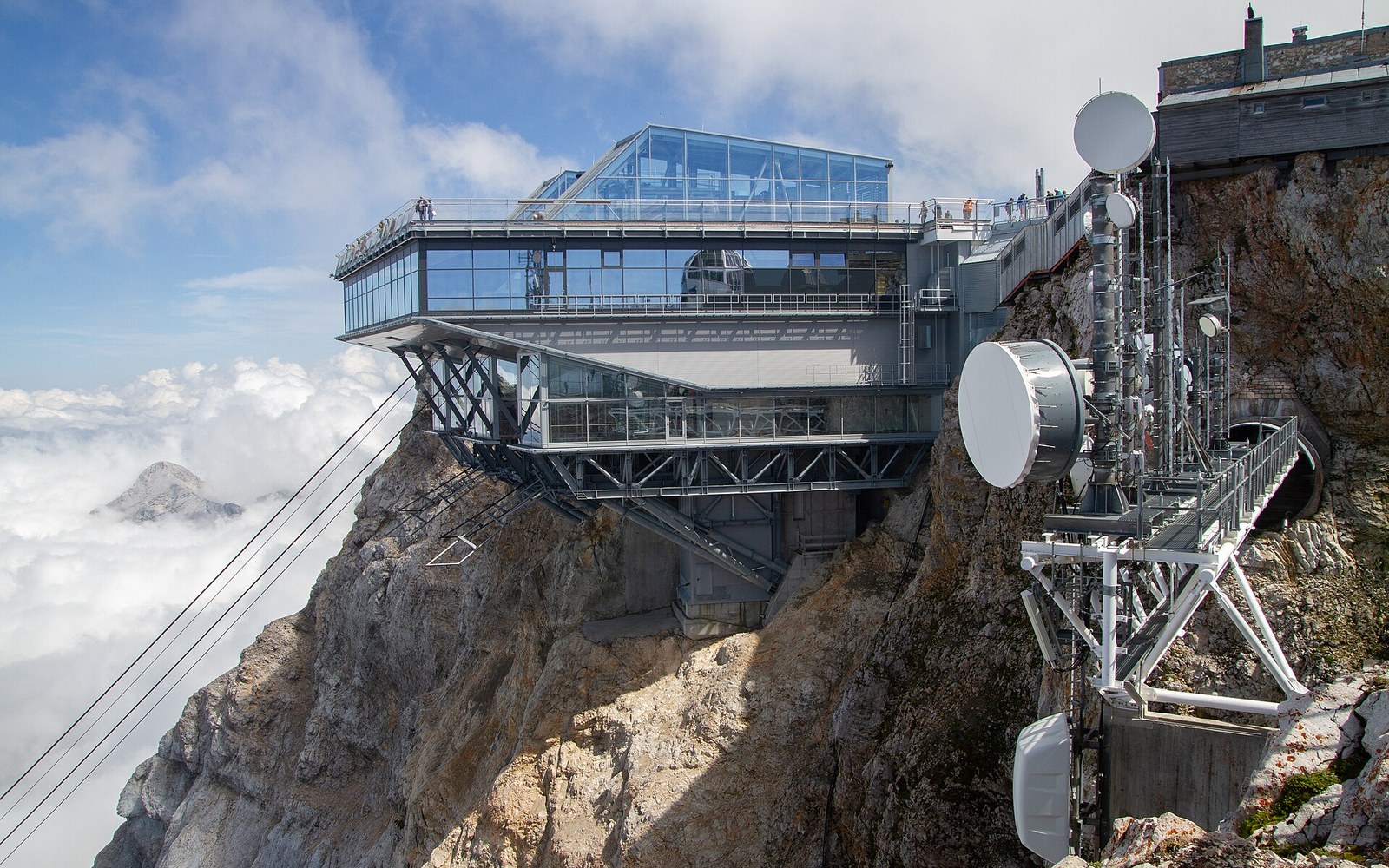
The summit cross on the Zugspitze was first erected in 1851, making it one of the older summit crosses in the Bavarian Alps, and successive replacements have maintained the tradition. The current cross is gilded and visible from the valley on bright days. Below it and to either side are the two sets of installations — weather station, restaurant, observation terraces — that serve each country's arriving visitors. The Bavarian and Tyrolean sides share a summit but not a cash register; the border runs between the facilities.
The Zugspitzplatt station underground is an unusual infrastructure in its own right. It is built inside the mountain, with tunnelled access passages leading to lifts and walkways that emerge onto the glacier plateau. Snow buries and re-covers the outdoor surfaces each winter, and the maintenance of clear access to the glacier-level exits is a continuous seasonal task. The plateau itself is used for glacier skiing, which gives the mountain a function beyond summit tourism and extends the season well past what lower Bavarian resorts can offer.
The meteorological station on the summit has the longest continuous observational record for the Zugspitze, with measurements extending back into the nineteenth century — a dataset used in studies of Alpine climate change. The Meteorologisches Observatorium Zugspitze ↗ is operated by the Deutscher Wetterdienst and makes the summit scientifically significant well beyond its tourism role.
Garmisch-Partenkirchen in the valley below, the town from which the railway departs, merged its two halves for the 1936 Winter Olympics and the combined settlement has remained the main railhead and service town for the mountain ever since. The Zugspitze defines the town's skyline and the town defines the Zugspitze's logistics; neither functions quite the same without the other.
The railway is what makes the mountain accessible to people who are not mountaineers, and that was the explicit ambition in 1930. What the summit cross, the border stone, and the retreating ice together make visible is something harder to quantify: a mountain that is working as a place — surveyed, measured, observed and argued over — as much as a thing to be climbed.